Wakarusa River Valley Vision and Area Plan
This process is the first implementation step toward the Open Space Plan priority
to proactively plan for Conservation of the Wakarusa River Corridor.
The developing Wakarusa Vision Plan (for short) is a collaboration between local governments, institutional partners, and the planning firm Biohabitats. It will serve as an actionable, guiding framework for balancing the diversity of conservation values within the river corridor and the needs of our growing community.
Phase 1: Learning
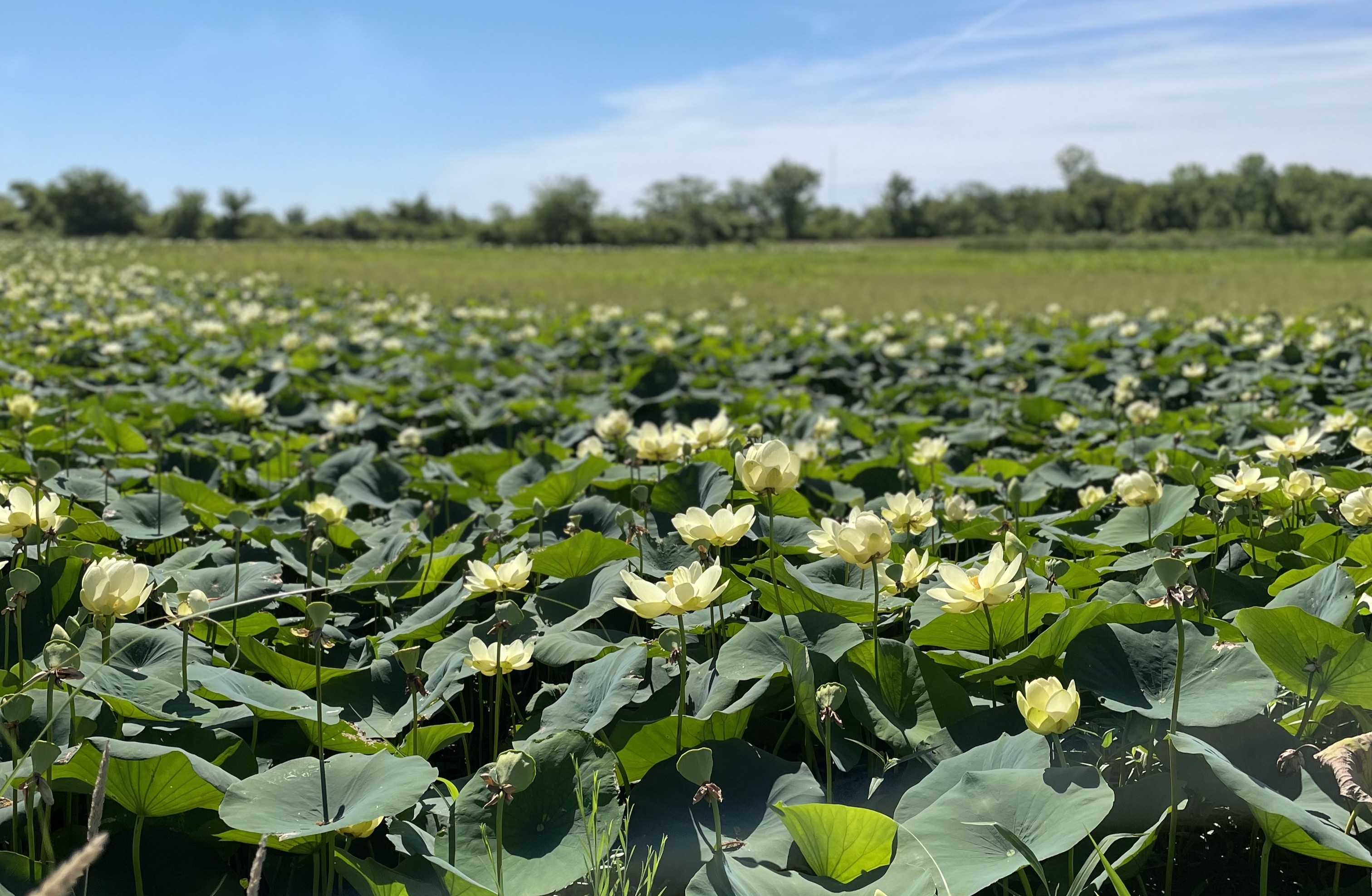
In spring and summer 2025, Biohabitats conducted comprehensive and layered analysis of a broad variety of data unique to the project area, from ecology and cultural heritage to infrastructure and land uses.
The learning phase also involved reviewing local and state plans and gathering insights from residents and experts connected to the Wakarusa River Valley, including Haskell students and faculty, environmental justice advocates, tourism and economic development perspectives, and conservation organizations. An invitation to complete an online survey was also mailed to property owners within the immediate project area.
The results of Phase 1 learning are synthesized in the Existing Conditions Summary slide deck and were used to inform workshop activities and scenarios in Phase 2.
Phase 2: Visioning
Using the complex context gathered during Phase 1, the project team held workshops with specific stakeholders, including the local planning partners, river valley landowners, agencies, and local experts, to gather input on potential Vision elements, including publicly accessible features, ecological stewardship strategies, and recognition of cultural and living heritage.
These late fall activities also included an on-campus open house for the Haskell community and a culminating open house for the public to view draft scenarios and provide additional perspective as the project moves into Phase 3.
Summaries of input received at the Haskell community event and public open house are available at the hyperlinks.
Phase 3: Strategizing
After studying the feedback and perspectives shared in Phase 2 and conducting additional investigation identified, a draft of the Vision Plan is underway. Once complete, the draft will be shared with the Board of County Commissioners for public review and input. The Wakarusa Vision Plan is expected to be finalized by fall 2026, with a public draft and presentation later this summer.
Who is the project team involved with this Plan?
Douglas County is leading this effort with Biohabitats, Alta Design, and Hoxie Collective. A local guiding team is made up of representatives of Douglas County, City of Lawrence, City of Eudora, and Haskell Indian Nations University.
Supplemental student projects and reports
The Wakarusa River Corridor is rich in educational opportunities. During development of this Plan, two particular academic efforts looked to the area as the basis of design and research for university courses and internships. The project team has been able to refer to these student contributions for additional context and inspiration where relevant.
Contributed Works
Wakarusa Wetlands Indigenous History and Giving Voice to Haskell: A Step Forward with the Memories of the Past by Tyler R. Moore, Haskell Indian Nations University alumni and graduate student in the University of Kansas Indigenous Studies program, prepared for the Biohabitats Interdisciplinary Internship Program.
Reimagining the Eudora River Access Site semester-long project, conducted by the Socio-Ecological Systems Studio (2nd year landscape architecture studio, Instructor: Dr. Hyung Jin Kim), part of Kansas State University’s Landscape Architecture and Regional & Community Planning program, resulted in the following:
- Wakarusa Regenerative Corridor and Eudora Riverside Revival by Isaac Morris and Taylor Stelter
- Wakarusa River Corridor Vision Plan and Eudora Boat Ramp Vision by Jillian Routhieaux, Ariel Gish, and Jenessa Broxterman
- Wakarusa Design Development and Eudora Site Redesign by Macey Wooldrik, Lauren Dexter, and Ja’Bron Bennett
- Wakarusa River Corridor Design Development by Katelyn Hays, Jade Johnson, and Kaylee Steele
- Wakarusa River Corridor: Design Development by Piper McCann and Zoe Spicer
Douglas County Wakarusa Corridor Assessment
Through FEMA technical assistance funding, the Kansas Department of Agriculture (KDA) Division of Water Resources led a hydrologic and hydraulic (H&H) assessment of the Wakarusa River east of Clinton Dam in partnership with Douglas County. This work helps build a better understanding of flood‑related conditions in the Wakarusa corridor and how they could be affected by future development. The effort, which began in spring 2025, also supports the ongoing development of the Wakarusa Vision Plan.
The Douglas County Wakarusa Corridor Assessment, along with an online presentation of the findings, is now available from KDA.